
Carte topographique Brusnica
Carte interactive
Cliquez sur la carte pour afficher l’altitude.
À propos de cette carte
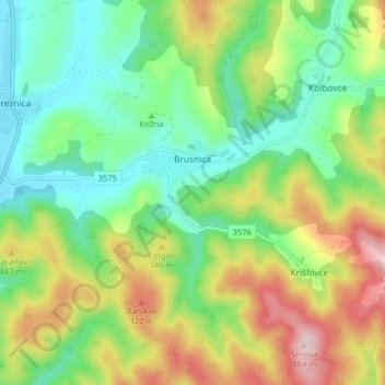
Nom : Carte topographique Brusnica, altitude, relief.
Altitude moyenne : 286 m
Altitude minimum : 172 m
Altitude maximum : 483 m
The municipality lies at an altitude of 199 metres and covers an area of 14.283 km². It has a population of about 415 people. The village has a significant Rusyn minority (32%) and smaller Romani minority (2%), along with the majority of Slovaks (65%).