
Carte topographique Garden Hill First Nation
Carte interactive
Cliquez sur la carte pour afficher l’altitude.
À propos de cette carte
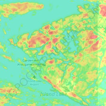
Nom : Carte topographique Garden Hill First Nation, altitude, relief.
Altitude moyenne : 236 m
Altitude minimum : 222 m
Altitude maximum : 268 m
Autres cartes topographiques
Cliquez sur une carte pour visualiser sa topographie, son altitude et son relief.
Island Lake
Canada > Manitoba > Garden Hill (Kistiganwacheeng) > Island Lake
Island Lake, Garden Hill (Kistiganwacheeng), Manitoba, Canada
Altitude moyenne : 228 m