
Carte topographique The Municipal District of Adare — Rathkeale
Carte interactive
Cliquez sur la carte pour afficher l’altitude.
À propos de cette carte
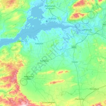
Nom : Carte topographique The Municipal District of Adare — Rathkeale, altitude, relief.
Altitude moyenne : 74 m
Altitude minimum : -7 m
Altitude maximum : 404 m