
Carte topographique Thamsbrück
Carte interactive
Cliquez sur la carte pour afficher l’altitude.
À propos de cette carte
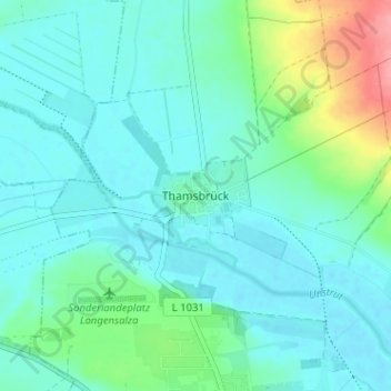
Nom : Carte topographique Thamsbrück, altitude, relief.
Altitude moyenne : 189 m
Altitude minimum : 171 m
Altitude maximum : 263 m
Thamsbrück is located in the west of the Thuringian Basin about 4 kilometres (2.5 mi) north of Bad Langensalza at an altitude of 175 metres (574 ft) above NHN. The surrounding area is agricultural. On the southern and western edge of the village, the Unstrut, with two river courses, flows eastwards to the Saale. The Welsbach, which comes from the north, flows into the Unstrut on the north-west side of the village.