
Carte topographique Loon op Zand
Carte interactive
Cliquez sur la carte pour afficher l’altitude.
Loon op Zand
Dutch Topographic map of the municipality of Loon op Zand, June 2015.
À propos de cette carte
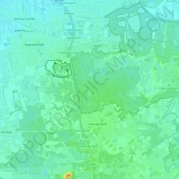
Nom : Carte topographique Loon op Zand, altitude, relief.
Lieu : Loon op Zand, North Brabant, Netherlands, The Netherlands (51.60568 4.98726 51.67683 5.10614)
Altitude moyenne : 9 m
Altitude minimum : 0 m
Altitude maximum : 39 m