
Carte topographique Lahos
Carte interactive
Cliquez sur la carte pour afficher l’altitude.
À propos de cette carte
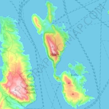
Nom : Carte topographique Lahos, altitude, relief.
Altitude moyenne : 109 m
Altitude minimum : 0 m
Altitude maximum : 888 m
It has sometimes been argued that this description does not match the topography of modern Ithaca. Three features of the description have been seen as especially problematic. First, Ithaca is described as "low-lying" (χθαμαλή), but Ithaca is mountainous. Second, the words "farthest out to sea, towards the sunset" (πανυπερτάτη εἰν ἁλὶ ... πρὸς ζόφον) are usually interpreted to mean that Ithaca must be the island furthest to the west, but Kefalonia lies to the west of Ithaca. Lastly, it is unclear which modern islands correspond to Homer's Doulichion and Same.