
Carte topographique Dannevirke
Carte interactive
Cliquez sur la carte pour afficher l’altitude.
Dannevirke
Dannevirke has an Oceanic climate, (Köppen:Cfb). Due its high altitude the summer temperatures are often cooler compared to other Eastern North Island towns, such as Masterton, Napier and Gisborne, while in winter Dannevirke can regularly experience frosts as in other parts of New Zealand. Snow is rare, the latest snow to hit Dannevirke was 15 August 2011.
À propos de cette carte
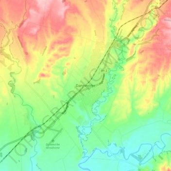
Nom : Carte topographique Dannevirke, altitude, relief.
Altitude moyenne : 221 m
Altitude minimum : 149 m
Altitude maximum : 314 m