Carte topographique Piravom
Cliquez sur la carte pour afficher l’altitude.
Piravom
Piravom was reverted to panchayat status in 1992 after two years as a municipality because of skepticism that its classification as a municipality would attract higher tax rates and building regulation. However, as modern municipal councils now have the authority to fix the tax rate and new building rule provisions are now applicable to special grade panchayats, the economic incentive for Piravom remaining a panchayat has disappeared. The local government of Piravom passed a unanimous resolution for elevation to municipality status. In 2015,The government of Kerala reclassified Piravom as a municipality.In 2021-2022, 2022-2023 LDF ruling Piravom municipality achieved 1st in the state for Ardra Keralam Award of Kerala Government on Best Health-services,cleanliness in the state .
À propos de cette carte
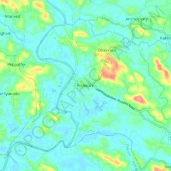
Nom : Carte topographique Piravom, altitude, relief.
Lieu : Piravom, Muvattupuzha, Ernakulam, Kerala, 686664, India (9.83337 76.45227 9.91337 76.53227)
Altitude moyenne : 23 m
Altitude minimum : -1 m
Altitude maximum : 111 m
Autres cartes topographiques
Cliquez sur une carte pour visualiser sa topographie, son altitude et son relief.