Carte topographique Akole
Cliquez sur la carte pour afficher l’altitude.
Akole
Kalsubai is the highest peak in Maharashtra, with an elevation of 1,646 meters (5,400 feet). Ghatghar, located 22 kilometers (14 miles) from Bhandardara, offers views of the Sahyadri range and is the site of the Udanchan Hydro-power project's first installation, which has a capacity of 250 MW. Additionally, Kokan Kada, situated near Harishchandragad, is known for its flat, sharp, and deeply edged mountainous terrain.
À propos de cette carte
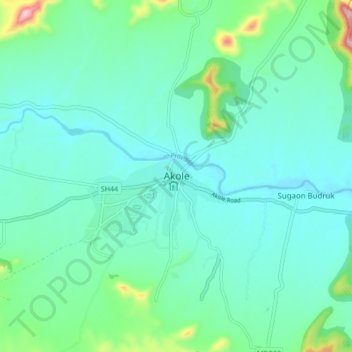
Nom : Carte topographique Akole, altitude, relief.
Lieu : Akole, Akola, Ahmednagar District, Maharashtra, 422600, India (19.38193 73.84926 19.70193 74.16926)
Altitude moyenne : 749 m
Altitude minimum : 553 m
Altitude maximum : 1 471 m
Autres cartes topographiques
Cliquez sur une carte pour visualiser sa topographie, son altitude et son relief.