
Carte topographique Amur Oblast
Carte interactive
Cliquez sur la carte pour afficher l’altitude.
Amur Oblast
Dwarf Siberian pine and alpine tundra grow at higher elevations and larch forests with small stands of flat-leaved birch and pine forests grow alongside the river plains. These larch and fir-spruce forests form the watershed of the Selemdzha River. The Bureya and Arkhara Rivers, southeast of the Selemdza, have the richest remaining forests in the oblast with Korean pine, Schisandra chinensis, Mongolian Oak, and other Manchurian flora. The Zeya–Bureya Plain, located between the Zeya, Amur, and Bureya Rivers, has the highest biodiversity in Amur Oblast. Much of this plain has been burned for agriculture, but large patches still remain. Japanese Daurian and Far Eastern western cranes nest here, as well as a host of other rare birds.
À propos de cette carte
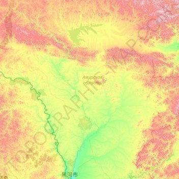
Nom : Carte topographique Amur Oblast, altitude, relief.
Lieu : Amur Oblast, Far Eastern Federal District, Russia (50.24324 125.87730 55.36324 130.99730)
Altitude moyenne : 463 m
Altitude minimum : 122 m
Altitude maximum : 2 036 m