
Carte topographique Bad Düben
Cliquez sur la carte pour afficher l’altitude.
À propos de cette carte
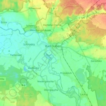
Nom : Carte topographique Bad Düben, altitude, relief.
Lieu : Bad Düben, Nordsachsen, Saxony, 04849, Germany (51.54128 12.48777 51.62795 12.64360)
Altitude moyenne : 98 m
Altitude minimum : 81 m
Altitude maximum : 134 m
Autres cartes topographiques
Cliquez sur une carte pour visualiser sa topographie, son altitude et son relief.