
Carte topographique ปาย
Carte interactive
Cliquez sur la carte pour afficher l’altitude.
À propos de cette carte
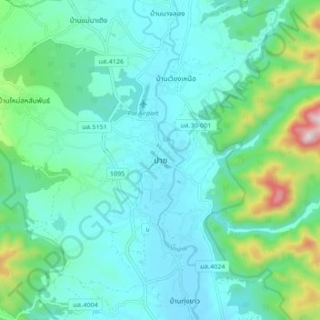
Nom : Carte topographique ปาย, altitude, relief.
Lieu : ปาย, Provinz Mae Hong Son, 58130, Thailand (19.31811 98.40058 19.39811 98.48058)
Altitude moyenne : 605 m
Altitude minimum : 487 m
Altitude maximum : 1 109 m
Autres cartes topographiques
Cliquez sur une carte pour visualiser sa topographie, son altitude et son relief.
บ้านแม่จ๋า
Thailand > Provinz Mae Hong Son
บ้านแม่จ๋า, Provinz Mae Hong Son, Thailand
Altitude moyenne : 531 m
Mae Hong Son
Thailand > Provinz Mae Hong Son > Mae Hong Son
Mae Hong Son, Provinz Mae Hong Son, 58000, Thailand
Altitude moyenne : 592 m