
Carte topographique Arosa
Carte interactive
Cliquez sur la carte pour afficher l’altitude.
À propos de cette carte
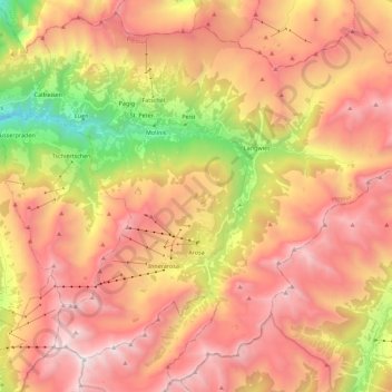
Nom : Carte topographique Arosa, altitude, relief.
Lieu : Arosa, Plessur, Grisons, Switzerland (46.72958 9.58322 46.87360 9.80700)
Altitude moyenne : 1 985 m
Altitude minimum : 694 m
Altitude maximum : 2 959 m
Before 2017, the municipality was in the Schanfigg sub-district of the Plessur district, after that date it was part of the Plessur Region. Located on the south-east slope of the Weisshorn chain, the town of Arosa is at the top of the Schanfigg valley at the foot of the Aroser Weisshorn (2,653 m (8,704 ft)). Adjoining are the areas of Innerarosa, Dorf-Obersee, Untersee and Maran-Prätschli at an elevation of 1,690 and 1,950 meters (5,540 and 6,400 ft).