
Carte topographique South Andaman
Carte interactive
Cliquez sur la carte pour afficher l’altitude.
À propos de cette carte
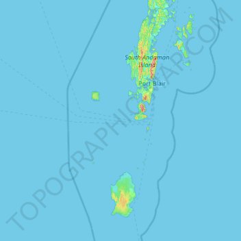
Nom : Carte topographique South Andaman, altitude, relief.
Lieu : South Andaman, Andaman and Nicobar Islands, India (10.30550 91.99180 12.37939 93.32719)
Altitude moyenne : 3 m
Altitude minimum : -1 m
Altitude maximum : 413 m
Autres cartes topographiques
Cliquez sur une carte pour visualiser sa topographie, son altitude et son relief.
South Brother Island
India > Andaman and Nicobar Islands
South Brother Island, South Andaman, Andaman and Nicobar Islands, India
Altitude moyenne : 1 m