
Carte topographique Ashbourne CP
Carte interactive
Cliquez sur la carte pour afficher l’altitude.
Ashbourne CP
Ashbourne lies at 53°01′N 01°44′W / 53.017°N 1.733°W / 53.017; -1.733. Ashbourne Green and Sturston are hamlets close by. Henmore Brook, a tributary of the River Dove, flows through the middle of the town. It has an elevation of 400 feet (122 m).
À propos de cette carte
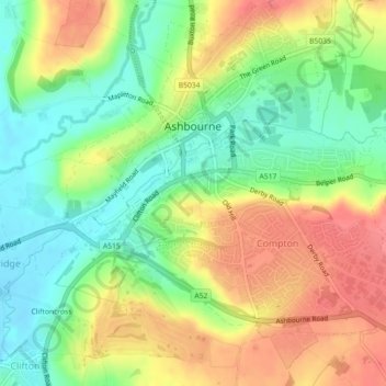
Nom : Carte topographique Ashbourne CP, altitude, relief.
Altitude moyenne : 147 m
Altitude minimum : 112 m
Altitude maximum : 187 m
Autres cartes topographiques
Cliquez sur une carte pour visualiser sa topographie, son altitude et son relief.