
Carte topographique Lipton
Cliquez sur la carte pour afficher l’altitude.
À propos de cette carte
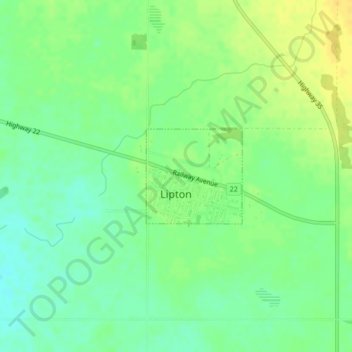
Nom : Carte topographique Lipton, altitude, relief.
Lieu : Lipton, Saskatchewan, Canada (50.89911 -103.85435 50.90640 -103.84265)
Altitude moyenne : 606 m
Altitude minimum : 596 m
Altitude maximum : 617 m
Autres cartes topographiques
Cliquez sur une carte pour visualiser sa topographie, son altitude et son relief.
McClean Lake
Canada > Saskatchewan > Division No. 18 > Unorganized Division No. 18
Altitude moyenne : 440 m
La Loche
Canada > Saskatchewan > Northern Saskatchewan Administration District > La Loche
Altitude moyenne : 447 m
Pelican Narrows
Canada > Saskatchewan > Northern Saskatchewan Administration District > Pelican Narrows
Altitude moyenne : 321 m