

Carte topographique Bintan Island
Cliquez sur la carte pour afficher l’altitude.
Bintan Island
Bintan, is the largest among the 3,200 islands of Riau Archipelago and is located 10 kilometres (6.2 mi) east of the Batam Island. It has a coast line of 105 kilometres (65 mi) and has rolling topography in its landform. The Riau Islands are a province of Indonesia, which encompassed the Riau Archipelago, Natuna Islands, Anambas, and Lingga Islands; in July 2004 the islands of Riau were divided from the existing Riau Province to form the new province with its capital at Tanjung Pinang. The archipelagos of Anambas and Natuna, located between mainland Malaysia and Borneo, are now part of this province
À propos de cette carte
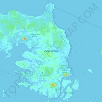
Nom : Carte topographique Bintan Island, altitude, relief.
Lieu : Bintan Island, Bintan, Riau Islands, Sumatra, Indonesia (0.80955 104.21381 1.22980 104.66254)
Altitude moyenne : 6 m
Altitude minimum : -4 m
Altitude maximum : 323 m
Autres cartes topographiques
Cliquez sur une carte pour visualiser sa topographie, son altitude et son relief.

