
Carte topographique Horst aan de Maas
Carte interactive
Cliquez sur la carte pour afficher l’altitude.
À propos de cette carte
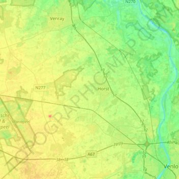
Nom : Carte topographique Horst aan de Maas, altitude, relief.
Lieu : Horst aan de Maas, Limburg, Netherlands, The Netherlands (51.37805 5.87497 51.52478 6.17898)
Altitude moyenne : 27 m
Altitude minimum : 9 m
Altitude maximum : 50 m
Dutch Topographic map of the municipality of Horst aan de Maas, June 2015.