
Carte topographique Lumbier
Carte interactive
Cliquez sur la carte pour afficher l’altitude.
À propos de cette carte
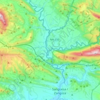
Nom : Carte topographique Lumbier, altitude, relief.
Lieu : Lumbier, Zangozerria / Comarca de Sangüesa, 31440, Spain (42.61312 -1.41902 42.68803 -1.17015)
Altitude moyenne : 591 m
Altitude minimum : 393 m
Altitude maximum : 1 341 m
Lumbier is located in the western part of the autonomous region of Navarre at an altitude of 467 metres above sea level. Its municipal area has an area of 57.40 km2 and has borders on the northern side with the municipalities of Urraúl Bajo and Romanzado, on the eastern side with the latter, on the southern side with those of Yesa, Liédena and Sangüesa and on the western side with that of Urraúl Alto.