
Carte topographique Sand Bay
Carte interactive
Cliquez sur la carte pour afficher l’altitude.
À propos de cette carte
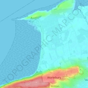
Nom : Carte topographique Sand Bay, altitude, relief.
Altitude moyenne : 15 m
Altitude minimum : 0 m
Altitude maximum : 112 m
Autres cartes topographiques
Cliquez sur une carte pour visualiser sa topographie, son altitude et son relief.
Golling
Vereinigtes Königreich > England > North Somerset > Banwell
Golling, Banwell, North Somerset, England, BS29 6DG, Vereinigtes Königreich
Altitude moyenne : 23 m