
Carte topographique Moreton Say
Carte interactive
Cliquez sur la carte pour afficher l’altitude.
À propos de cette carte
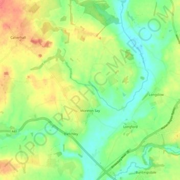
Nom : Carte topographique Moreton Say, altitude, relief.
Altitude moyenne : 85 m
Altitude minimum : 59 m
Altitude maximum : 121 m
Autres cartes topographiques
Cliquez sur une carte pour visualiser sa topographie, son altitude et son relief.
Longford
United Kingdom > England > Longford
Longford, Gloucestershire, South West England, England, GL2 9BT, United Kingdom
Altitude moyenne : 14 m
Longford
United Kingdom > England > Longford
Longford, Derbyshire, East Midlands, England, DE6 3DR, United Kingdom
Altitude moyenne : 96 m