

Carte topographique Coniston Water
Cliquez sur la carte pour afficher l’altitude.
Coniston Water
Coniston Water in the English county of Cumbria is the third-largest lake in the Lake District by volume (after Windermere and Ullswater), and the fifth-largest by area. It is five miles long by half a mile wide (8 km by 800 m), has a maximum depth of 184 feet (56 m), and covers an area of 1.89 square miles (4.9 km2). The lake has an elevation of 143 feet (44 m) above sea level. It drains to the sea via the River Crake.
À propos de cette carte
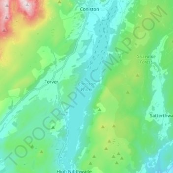
Nom : Carte topographique Coniston Water, altitude, relief.
Altitude moyenne : 186 m
Altitude minimum : 17 m
Altitude maximum : 791 m
Autres cartes topographiques
Cliquez sur une carte pour visualiser sa topographie, son altitude et son relief.
Whitestone Moss
United Kingdom > England > Cumbria > South Lakeland > High Nibthwaite > Houkler Hall
Altitude moyenne : 102 m