Carte topographique Brawley
Cliquez sur la carte pour afficher l’altitude.
Brawley
Brawley is located in the Colorado Desert and Lower Colorado River Valley regions. The city's elevation, like other Imperial Valley towns, is below sea level.
À propos de cette carte
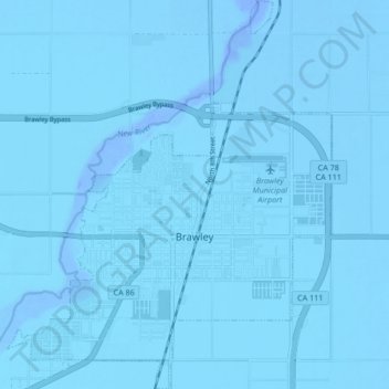
Nom : Carte topographique Brawley, altitude, relief.
Lieu : Brawley, Imperial County, California, 92227, United States (32.95098 -115.57096 33.02155 -115.50055)
Altitude moyenne : -37 m
Altitude minimum : -54 m
Altitude maximum : -24 m
Autres cartes topographiques
Cliquez sur une carte pour visualiser sa topographie, son altitude et son relief.
Salton Sea
United States > California > Imperial County
The Gulf of California would extend as far north as the city of Indio, were it not for the delta created by the Colorado River. Over three million years, through all of the Pleistocene, the river's delta expanded until it cut off the northern part of the gulf. Since then, the Colorado River has alternated…
Altitude moyenne : 9 m
Salton Sea
United States > California > Imperial County
The Gulf of California would extend as far north as the city of Indio, were it not for the delta created by the Colorado River. Over three million years, through all of the Pleistocene, the river's delta expanded until it cut off the northern part of the gulf. Since then, the Colorado River has alternated…
Altitude moyenne : 9 m
Salton Sea
United States > California > Imperial County
The Gulf of California would extend as far north as the city of Indio, were it not for the delta created by the Colorado River. Over three million years, through all of the Pleistocene, the river's delta expanded until it cut off the northern part of the gulf. Since then, the Colorado River has alternated…
Altitude moyenne : 9 m
Salton City
United States > California > Imperial County
In the 1970s, most of the buildings constructed along the shoreline, including the city's marina were abandoned due to rising sea elevation. In the 1980s, the Imperial Irrigation District took proactive water conservation measures to reduce the flow of unused canal water into the Salton Sea. Throughout the…
Altitude moyenne : -40 m
Salton Sea
United States > California > Imperial County
The Gulf of California would extend as far north as the city of Indio, some 150 miles (240 km) northwest of its current limits, were it not for the delta created by the Colorado River. Over three million years, through all of the Pleistocene, the river's delta expanded until it cut off the northern part of the…
Altitude moyenne : 9 m