
Carte topographique Islands District
Carte interactive
Cliquez sur la carte pour afficher l’altitude.
À propos de cette carte
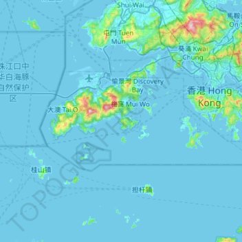
Nom : Carte topographique Islands District, altitude, relief.
Lieu : Islands District, New Territories, Hong Kong, China (22.13672 113.81724 22.32463 114.30923)
Altitude moyenne : 36 m
Altitude minimum : -10 m
Altitude maximum : 938 m
Autres cartes topographiques
Cliquez sur une carte pour visualiser sa topographie, son altitude et son relief.
Tai Po
China > Hong Kong > Tai Po District
Tai Po, Tai Po District, New Territories, Hong Kong, China
Altitude moyenne : 155 m
Junk Bay
China > Hong Kong > Sai Kung District > Tseung Kwan O
Junk Bay, Kwun Tong District, Tseung Kwan O, Sai Kung District, New Territories, Hong Kong, China
Altitude moyenne : 29 m
Kowloon City District
Kowloon City District, Kowloon, Hong Kong, 000000, China
Altitude moyenne : 37 m