

Carte topographique Mal Bajwar
Cliquez sur la carte pour afficher l’altitude.
À propos de cette carte
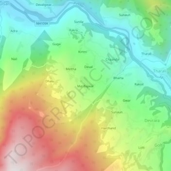
Nom : Carte topographique Mal Bajwar, altitude, relief.
Lieu : Mal Bajwar, Tharali, Chamoli, Uttarakhand, 246481, India (30.05109 79.45993 30.09109 79.49993)
Altitude moyenne : 1 632 m
Altitude minimum : 1 124 m
Altitude maximum : 2 443 m
Autres cartes topographiques
Cliquez sur une carte pour visualiser sa topographie, son altitude et son relief.
Pindar
India > Uttarakhand > Tharali
The Pindar River is a river located in Uttarakhand, India. The Pindar originates from Pindari Glacier which is located in Bageshwar district of Kumaon region in Uttarakhand. The source of this river, the Pindar glacier is located at an altitude of 3,820 m (12,530 ft). Pindar glacier has relatively easier…
Altitude moyenne : 2 533 m
