
Carte topographique Imperial Park
Carte interactive
Cliquez sur la carte pour afficher l’altitude.
À propos de cette carte
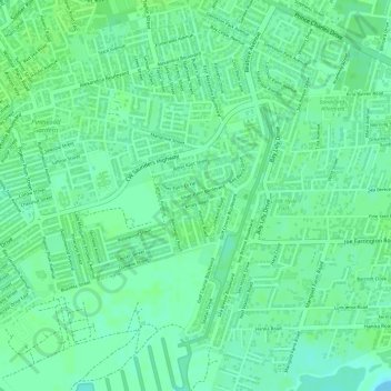
Nom : Carte topographique Imperial Park, altitude, relief.
Lieu : Imperial Park, New Providence, The Bahamas (25.02329 -77.32110 25.03316 -77.31300)
Altitude moyenne : 6 m
Altitude minimum : 0 m
Altitude maximum : 9 m
Autres cartes topographiques
Cliquez sur une carte pour visualiser sa topographie, son altitude et son relief.
Sunshine Park
Sunshine Park, New Providence, The Bahamas
Altitude moyenne : 7 m
Coconut Grove
The Bahamas > Coconut Grove > New Providence
Coconut Grove, New Providence, The Bahamas
Altitude moyenne : 8 m
Emerald Coast
Emerald Coast, New Providence, The Bahamas
Altitude moyenne : 7 m