
Carte topographique Fort Albany
Cliquez sur la carte pour afficher l’altitude.
À propos de cette carte
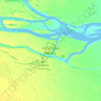
Nom : Carte topographique Fort Albany, altitude, relief.
Altitude moyenne : 9 m
Altitude minimum : -4 m
Altitude maximum : 20 m
Autres cartes topographiques
Cliquez sur une carte pour visualiser sa topographie, son altitude et son relief.
Ptarmigan Lake
Canada > Ontario > Cochrane District > Unorganized North Cochrane
Altitude moyenne : 225 m
Painkiller Lake
Canada > Ontario > Cochrane District > Black River-Matheson Township
Altitude moyenne : 302 m
Borgford Lake
Canada > Ontario > Cochrane District > Black River-Matheson Township
Altitude moyenne : 346 m
Kapuskasing
Canada > Ontario > Cochrane District
Kapuskasing lies in the heart of the Great Clay Belt. The topography of the region is very flat, dotted with numerous small lakes and muskeg bogs. Also in the heart of Canada's boreal forest, the region is drained by rivers running north to James Bay. The district is heavily forested, mostly by thick stands of…
Altitude moyenne : 227 m
Arrow Lake
Canada > Ontario > Cochrane District > Unorganized South West Cochrane
Altitude moyenne : 297 m
Watersnake Lake
Canada > Ontario > Cochrane District > Fauquier-Strickland Township
Altitude moyenne : 233 m
Kabinakagami River
Canada > Ontario > Cochrane District > Unorganized North Cochrane
Altitude moyenne : 250 m
Unorganized South West Cochrane
Canada > Ontario > Cochrane District > Unorganized South West Cochrane
Altitude moyenne : 312 m
Watabeag River
Canada > Ontario > Cochrane District > Black River-Matheson Township
Altitude moyenne : 261 m
Joseph Lake
Canada > Ontario > Cochrane District > Unorganized North Cochrane
Altitude moyenne : 271 m
Moose Factory Island
Canada > Ontario > Cochrane District > Unorganized North Cochrane
Altitude moyenne : 4 m
Wadsworth Lake
Canada > Ontario > Cochrane District > Unorganized North Cochrane
Altitude moyenne : 323 m
Ghost River
Canada > Ontario > Cochrane District > Unorganized North Cochrane
Altitude moyenne : 287 m
Cochrane
Canada > Ontario > Cochrane District
Until 1977, Timmins was used as the source for all weather readings attributed to Cochrane except for exceptional extremes, due to the overall similar climate due to proximity and topography. However, in December 1977, Cochrane temperature readings began to be taken from downtown after a noticeable difference…
Altitude moyenne : 262 m
Ghost Lake;Pearce Creek
Canada > Ontario > Cochrane District > Unorganized North Cochrane
Altitude moyenne : 213 m
Moose Factory Island
Canada > Ontario > Cochrane District > Unorganized North Cochrane
Altitude moyenne : 4 m
Kapuskasing
Canada > Ontario > Cochrane District
Kapuskasing lies in the heart of the Great Clay Belt. The topography of the region is very flat, dotted with numerous small lakes and muskeg bogs. Also in the heart of Canada's boreal forest, the region is drained by rivers running north to James Bay. The district is heavily forested, mostly by thick stands of…
Altitude moyenne : 227 m
Big Cedar Creek
Canada > Ontario > Cochrane District > Unorganized North Cochrane
Altitude moyenne : 49 m