
Carte topographique Lebanon
Carte interactive
Cliquez sur la carte pour afficher l’altitude.
À propos de cette carte
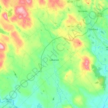
Nom : Carte topographique Lebanon, altitude, relief.
Lieu : Lebanon, York County, Maine, 04027, United States (43.32569 -70.98843 43.48059 -70.81347)
Altitude moyenne : 121 m
Altitude minimum : 51 m
Altitude maximum : 267 m
According to the United States Census Bureau, the town has a total area of 55.83 square miles (144.60 km2), of which, 55.00 square miles (142.45 km2) of it is land and 0.83 square miles (2.15 km2) is water. Lebanon is drained by the Little River and Salmon Falls River. The town's highest point is Prospect Hill, 880 feet (268 m) above sea level. The lowest elevation borders the Salmon Falls River, on the town's southernmost boundary, which is approximately 170 feet (52 m) above sea level.