
Carte topographique Cairo
Carte interactive
Cliquez sur la carte pour afficher l’altitude.
À propos de cette carte
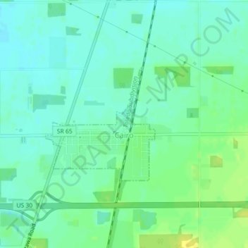
Nom : Carte topographique Cairo, altitude, relief.
Lieu : Cairo, Allen County, Ohio, 45820, United States (40.82698 -84.09318 40.83927 -84.07743)
Altitude moyenne : 249 m
Altitude minimum : 241 m
Altitude maximum : 261 m
The elevation of the land area of Cairo (ranges from about 812' at the west end to 842' at the east end of the village above sea level) is benchmarked at 815 feet (248 m) above sea level, generally flat and moderately wooded. The nearest stream with year-round flow is Rattlesnake Creek, which flows from south of the village and passes just to the west of the village. Water flow in the village is generally from the south and east to the north and west.
Autres cartes topographiques
Cliquez sur une carte pour visualiser sa topographie, son altitude et son relief.
Lima
United States > Ohio > Allen County
Lima, Allen County, Ohio, 45804, United States
Altitude moyenne : 267 m
Spencerville
United States > Ohio > Allen County
Spencerville, Allen County, Ohio, 45887, United States
Altitude moyenne : 254 m
Bluffton
United States > Ohio > Allen County
Bluffton, Allen County, Ohio, 45817, United States
Altitude moyenne : 255 m
Delphos
United States > Ohio > Allen County
Delphos, Allen County, Ohio, 45833, United States
Altitude moyenne : 236 m
Maysville
United States > Ohio > Allen County
Maysville, Jackson Township, Allen County, Ohio, United States
Altitude moyenne : 307 m
Kemp
United States > Ohio > Allen County
Kemp, Allen County, Ohio, United States
Altitude moyenne : 256 m
Landeck
United States > Ohio > Allen County
Landeck, Allen County, Ohio, United States
Altitude moyenne : 242 m
Scotts Crossing
United States > Ohio > Allen County
Scotts Crossing, Allen County, Ohio, United States
Altitude moyenne : 239 m
Hume
United States > Ohio > Allen County
Hume, Allen County, Ohio, United States
Altitude moyenne : 260 m
Gomer
United States > Ohio > Allen County
Gomer, Allen County, Ohio, 45809, United States
Altitude moyenne : 237 m
West Newton
United States > Ohio > Allen County
West Newton, Auglaize Township, Allen County, Ohio, United States
Altitude moyenne : 316 m
Southworth
United States > Ohio > Allen County
Southworth, Allen County, Ohio, United States
Altitude moyenne : 247 m
South Warsaw
United States > Ohio > Allen County
South Warsaw, Perry Township, Allen County, Ohio, United States
Altitude moyenne : 283 m
Rockport
United States > Ohio > Allen County
Rockport, Monroe Township, Allen County, Ohio, 45830, United States
Altitude moyenne : 248 m
Conant
United States > Ohio > Allen County
Conant, Allen County, Ohio, United States
Altitude moyenne : 251 m
Allentown
United States > Ohio > Allen County > Lima
Allentown, Lima, Allen County, Ohio, 45805, United States
Altitude moyenne : 250 m
Westminster
United States > Ohio > Allen County
Westminster, Auglaize Township, Allen County, Ohio, United States
Altitude moyenne : 294 m
Elida
United States > Ohio > Allen County
Elida, Allen County, Ohio, United States
Altitude moyenne : 244 m
Beaverdam
United States > Ohio > Allen County
Beaverdam, Allen County, Ohio, 45808, United States
Altitude moyenne : 264 m
Fort Shawnee
United States > Ohio > Allen County
Fort Shawnee, Allen County, Ohio, 45806, United States
Altitude moyenne : 268 m
Lafayette
United States > Ohio > Allen County
Lafayette, Allen County, Ohio, 45854, United States
Altitude moyenne : 286 m
Lima
United States > Ohio > Allen County
Lima, Allen County, Ohio, 45804, United States
Altitude moyenne : 267 m
Harrod
United States > Ohio > Allen County
Harrod, Allen County, Ohio, United States
Altitude moyenne : 305 m