
Carte topographique Bhandara City
Carte interactive
Cliquez sur la carte pour afficher l’altitude.
À propos de cette carte
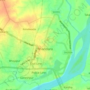
Nom : Carte topographique Bhandara City, altitude, relief.
Lieu : Bhandara City, Bhandara Taluka, Bhandara, Maharashtra, India (21.14292 79.63572 21.20357 79.68523)
Altitude moyenne : 252 m
Altitude minimum : 236 m
Altitude maximum : 272 m
Bhandara is located at 21°10′N 79°39′E / 21.17°N 79.65°E / 21.17; 79.65 in the north-east part of the state. It has an average elevation of 244 metres (800 feet).