
Carte topographique Vyšná Rybnica
Carte interactive
Cliquez sur la carte pour afficher l’altitude.
Vyšná Rybnica
The village lies at an altitude of 222 metres and covers an area of 40.082 km². It has a population of 375 people.
À propos de cette carte
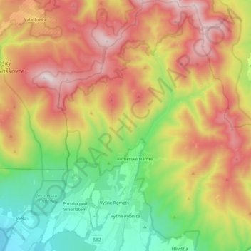
Nom : Carte topographique Vyšná Rybnica, altitude, relief.
Altitude moyenne : 538 m
Altitude minimum : 109 m
Altitude maximum : 1 047 m