
Carte topographique Yingjiang County
Carte interactive
Cliquez sur la carte pour afficher l’altitude.
Yingjiang County
Yingjiang county is mountainous with several alluvial plains. The county has various climate types, with ranges from the tropical, the subtropical, to the temperate zones. Intact forests can be seen in the mountains above 2,000 m (6,600 ft). The elevations vary from 210 to 3,404.6 m (689 to 11,170 ft).
À propos de cette carte
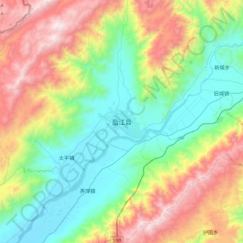
Nom : Carte topographique Yingjiang County, altitude, relief.
Lieu : Yingjiang County, Dehong, Yunnan, 665000, China (24.54844 97.77172 24.86844 98.09172)
Altitude moyenne : 1 428 m
Altitude minimum : 794 m
Altitude maximum : 2 654 m