
Carte topographique JawaharNagar Colony Park
Carte interactive
Cliquez sur la carte pour afficher l’altitude.
À propos de cette carte
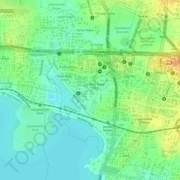
Nom : Carte topographique JawaharNagar Colony Park, altitude, relief.
Altitude moyenne : 524 m
Altitude minimum : 508 m
Altitude maximum : 546 m
Autres cartes topographiques
Cliquez sur une carte pour visualiser sa topographie, son altitude et son relief.
Durgam Cheruvu
Durgam Cheruvu, Inorbit Mall Road, CBI Colony, Ward 104 Kondapur, Greater Hyderabad Municipal Corporation West Zone, Hyderabad, Serilingampalle mandal, Rangareddy, Telangana, 996544, India
Altitude moyenne : 577 m
Ward 104 Kondapur
Ward 104 Kondapur, Greater Hyderabad Municipal Corporation West Zone, Hyderabad, Rangareddy, Telangana, India
Altitude moyenne : 582 m
Amber cheruvu
Amber cheruvu, Eswar Villas road, Sreenivasa Nagar, Ward 123 Hydernagar, Greater Hyderabad Municipal Corporation West Zone, Hyderabad, Kukatpally mandal, Medchal–Malkajgiri, Telangana, 500085, India
Altitude moyenne : 590 m
Greater Hyderabad Municipal Corporation Central Zone
Greater Hyderabad Municipal Corporation Central Zone, Hyderabad, Khairatabad mandal, Hyderabad, Telangana, India
Altitude moyenne : 533 m
Greater Hyderabad Municipal Corporation South Zone
Greater Hyderabad Municipal Corporation South Zone, Hyderabad, Bahadurpura mandal, Hyderabad, Telangana, India
Altitude moyenne : 535 m
Kappala Cheruvu
Kappala Cheruvu, SH19, sripuram, Ward 14 BN Reddy Nagar, Greater Hyderabad Municipal Corporation East Zone, Hyderabad, Hayathnagar mandal, Rangareddy, Telangana, 500070, India
Altitude moyenne : 537 m
Ward 135 Venkatapuram
Ward 135 Venkatapuram, Greater Hyderabad Municipal Corporation North Zone, Hyderabad, Medchal–Malkajgiri, Telangana, India
Altitude moyenne : 556 m