
Carte topographique Nyotha - Benezeth
Carte interactive
Cliquez sur la carte pour afficher l’altitude.
À propos de cette carte
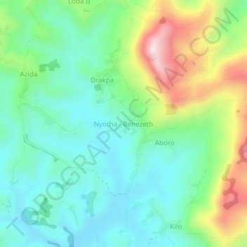
Nom : Carte topographique Nyotha - Benezeth, altitude, relief.
Lieu : Nyotha - Benezeth, Ituri, DR Congo (1.97817 30.84028 2.01817 30.88028)
Altitude moyenne : 2 067 m
Altitude minimum : 1 907 m
Altitude maximum : 2 431 m