
Carte topographique Herford
Carte interactive
Cliquez sur la carte pour afficher l’altitude.
À propos de cette carte
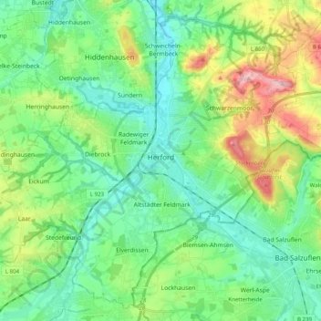
Nom : Carte topographique Herford, altitude, relief.
Lieu : Herford, Kreis Herford, North Rhine-Westphalia, Germany (52.05786 8.55705 52.16994 8.75460)
Altitude moyenne : 107 m
Altitude minimum : 56 m
Altitude maximum : 237 m
Autres cartes topographiques
Cliquez sur une carte pour visualiser sa topographie, son altitude et son relief.
Herford
Germany > North Rhine-Westphalia > Kreis Herford > Herford
Herford, Kreis Herford, North Rhine-Westphalia, Germany
Altitude moyenne : 91 m