
Carte topographique Pasighat
Cliquez sur la carte pour afficher l’altitude.
Pasighat
Pasighat is located at 28°04′N 95°20′E / 28.07°N 95.33°E / 28.07; 95.33. It has an average elevation of 153 metres or 502 feet. Pasighat has a typical lowland Northeast India humid subtropical climate (Köppen Cwa) a little too cool to qualify as a tropical monsoon climate (Am).
À propos de cette carte
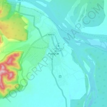
Nom : Carte topographique Pasighat, altitude, relief.
Lieu : Pasighat, Pasighat HQ, East Siang, Arunachal Pradesh, India (28.01897 95.29249 28.09897 95.37249)
Altitude moyenne : 179 m
Altitude minimum : 139 m
Altitude maximum : 393 m