
Carte topographique Crowthorne
Carte interactive
Cliquez sur la carte pour afficher l’altitude.
À propos de cette carte
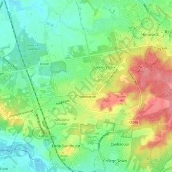
Nom : Carte topographique Crowthorne, altitude, relief.
Lieu : Crowthorne, Bracknell Forest, England, United Kingdom (51.35798 -0.81973 51.39086 -0.72733)
Altitude moyenne : 82 m
Altitude minimum : 49 m
Altitude maximum : 135 m
Autres cartes topographiques
Cliquez sur une carte pour visualiser sa topographie, son altitude et son relief.
Bracknell
United Kingdom > England > Bracknell Forest
Bracknell, Bracknell Forest, England, United Kingdom
Altitude moyenne : 80 m