
Carte topographique Princetown
Carte interactive
Cliquez sur la carte pour afficher l’altitude.
À propos de cette carte
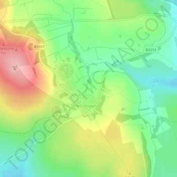
Nom : Carte topographique Princetown, altitude, relief.
Altitude moyenne : 415 m
Altitude minimum : 347 m
Altitude maximum : 513 m
Princetown, like the rest of Dartmoor, experiences colder and wetter weather than most of Devon, especially because of its high altitude. Snow is uncommon but is usually heavy when it does fall. According to the Köppen climate classification the climate would be classified as Cfb bordering on Cfc.
Autres cartes topographiques
Cliquez sur une carte pour visualiser sa topographie, son altitude et son relief.
Tavistock
United Kingdom > England > Devon > West Devon
Tavistock, West Devon, Devon, England, United Kingdom
Altitude moyenne : 139 m
Chagford
United Kingdom > England > Devon > West Devon
Chagford, West Devon, Devon, England, United Kingdom
Altitude moyenne : 309 m