
Carte topographique Gaanderen
Carte interactive
Cliquez sur la carte pour afficher l’altitude.
À propos de cette carte
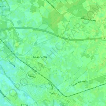
Nom : Carte topographique Gaanderen, altitude, relief.
Lieu : Gaanderen, Doetinchem, Gelderland, Nederland (51.92278 6.32147 51.95460 6.39629)
Altitude moyenne : 17 m
Altitude minimum : 11 m
Altitude maximum : 21 m
Autres cartes topographiques
Cliquez sur une carte pour visualiser sa topographie, son altitude et son relief.
Wijnbergen
Nederland > Gelderland > Doetinchem
Wijnbergen, Doetinchem, Gelderland, Nederland, 7007 CA, Nederland
Altitude moyenne : 15 m
Wehl
Nederland > Gelderland > Doetinchem
Wehl, Doetinchem, Gelderland, Nederland
Altitude moyenne : 14 m