
Carte topographique Hardeol
Carte interactive
Cliquez sur la carte pour afficher l’altitude.
À propos de cette carte
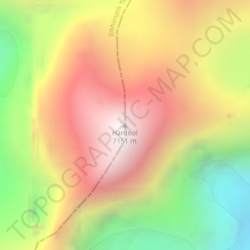
Nom : Carte topographique Hardeol, altitude, relief.
Altitude moyenne : 6 228 m
Altitude minimum : 5 235 m
Altitude maximum : 7 111 m
Autres cartes topographiques
Cliquez sur une carte pour visualiser sa topographie, son altitude et son relief.
Joshimath
India > Uttarakhand > Joshimath Tehsil
Joshimath, Joshimath Tehsil, Chamoli district, Uttarakhand, India
Altitude moyenne : 2 272 m