
Carte topographique Durango
Carte interactive
Cliquez sur la carte pour afficher l’altitude.
À propos de cette carte
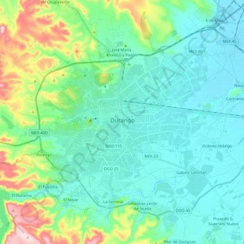
Nom : Carte topographique Durango, altitude, relief.
Lieu : Durango, Municipio de Durango, Durango, Mexico (23.94563 -104.73078 24.09514 -104.51793)
Altitude moyenne : 1 936 m
Altitude minimum : 1 860 m
Altitude maximum : 2 225 m
Durango (Spanish pronunciation: [duˈɾaŋɡo], Southeastern Tepehuan: Korian), is the capital and largest city of the northern Mexican state of Durango and the seat of the Durango municipality. It has a population of 654,876 as of the 2015 census. The city's official name is Victoria de Durango, Victoria having been added in honor of the first president of Mexico, Guadalupe Victoria, who hailed from the state of Durango. The city is located in the Valley of Guadiana and sits at an altitude of 1,890 m (6,201 ft).