
Carte topographique Fansipan
Carte interactive
Cliquez sur la carte pour afficher l’altitude.
À propos de cette carte
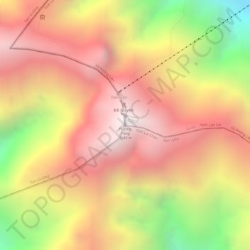
Nom : Carte topographique Fansipan, altitude, relief.
Altitude moyenne : 2 616 m
Altitude minimum : 1 822 m
Altitude maximum : 3 099 m
Fansipan is the tallest mountain in the Hoang Lien Son Range, situated on the border of Lào Cai Province and Lai Châu Province with its peak located on the Lào Cai side. The mountain is part of the Hoàng Liên National Park. It has a topographic prominence of 1,613 metres (5,292 ft), ranking 6th in Vietnam.
Autres cartes topographiques
Cliquez sur une carte pour visualiser sa topographie, son altitude et son relief.
Cat Cat Village
Vietnam > Lao Cai province > Sa Pa > Hoang Lien Commune
Cat Cat Village, Hoang Lien Commune, Sa Pa, Lào Cai Province, 33000, Vietnam
Altitude moyenne : 1 421 m