
Carte topographique Camira Glebe
Carte interactive
Cliquez sur la carte pour afficher l’altitude.
À propos de cette carte
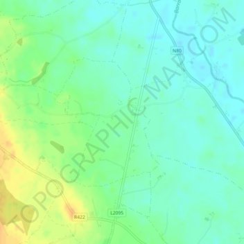
Nom : Carte topographique Camira Glebe, altitude, relief.
Altitude moyenne : 82 m
Altitude minimum : 71 m
Altitude maximum : 101 m
Autres cartes topographiques
Cliquez sur une carte pour visualiser sa topographie, son altitude et son relief.
O'More's Forest ED
O'More's Forest ED, The Municipal District of Borris-in-Ossory — Mountmellick, County Laois, Leinster, Ireland
Altitude moyenne : 97 m
Rathdowney
Ireland > County Laois > Rathdowney
Rathdowney, The Municipal District of Borris-in-Ossory — Mountmellick, County Laois, Leinster, R32 H773, Ireland
Altitude moyenne : 110 m