
Carte topographique Làng Inao
Carte interactive
Cliquez sur la carte pour afficher l’altitude.
À propos de cette carte
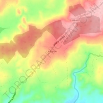
Nom : Carte topographique Làng Inao, altitude, relief.
Lieu : Làng Inao, Chư Prông District, Gia Lai Province, Vietnam (13.65552 107.78542 13.69552 107.82542)
Altitude moyenne : 352 m
Altitude minimum : 258 m
Altitude maximum : 424 m
Autres cartes topographiques
Cliquez sur une carte pour visualiser sa topographie, son altitude et son relief.
Landing Zone X-Ray
Vietnam > Gia Lai Province > Chư Prông District
Landing Zone X-Ray, Quốc lộ 14C, Chư Prông District, Gia Lai Province, Vietnam
Altitude moyenne : 229 m