
Carte topographique Epping Forest
Carte interactive
Cliquez sur la carte pour afficher l’altitude.
À propos de cette carte
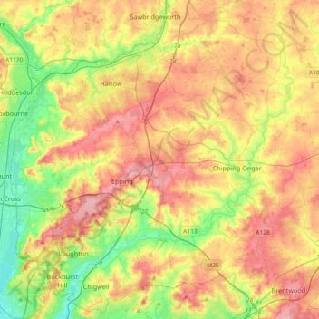
Nom : Carte topographique Epping Forest, altitude, relief.
Lieu : Epping Forest, Essex, East of England, England, United Kingdom (51.60447 -0.01977 51.82215 0.34757)
Altitude moyenne : 65 m
Altitude minimum : 9 m
Altitude maximum : 121 m
Autres cartes topographiques
Cliquez sur une carte pour visualiser sa topographie, son altitude et son relief.
Stapleford Abbotts
United Kingdom > England > Epping Forest
Stapleford Abbotts, Epping Forest, Essex, England, United Kingdom
Altitude moyenne : 59 m
Loughton
United Kingdom > England > Epping Forest
Loughton, Epping Forest, Essex, England, United Kingdom
Altitude moyenne : 61 m