
Carte topographique Ambrolauri
Carte interactive
Cliquez sur la carte pour afficher l’altitude.
Ambrolauri
Ambrolauri (Georgian: ამბროლაური) is a city in Georgia, located in the northwestern part of the country, on both banks of the Rioni river, at an elevation of 550 m above sea level. The city serves as the seat of the Racha-Lechkhumi and Kvemo Svaneti regional administration and of the Ambrolauri Municipality and had a population of 2,015 in 2021. Its area is 2.8 km2. Ambrolauri was first recorded in the 17th century as a place, where one of the palaces of the kings of Imereti was located. It acquired the city status in 1966.
À propos de cette carte
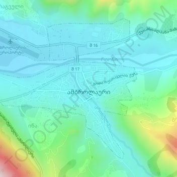
Nom : Carte topographique Ambrolauri, altitude, relief.
Altitude moyenne : 624 m
Altitude minimum : 536 m
Altitude maximum : 971 m