
Carte topographique Area E (Cowichan Station / Sahtlam / Glenora)
Carte interactive
Cliquez sur la carte pour afficher l’altitude.
À propos de cette carte
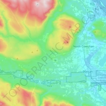
Nom : Carte topographique Area E (Cowichan Station / Sahtlam / Glenora), altitude, relief.
Altitude moyenne : 287 m
Altitude minimum : -1 m
Altitude maximum : 1 185 m