
Faire un don
Équipez-vous pour votre prochaine aventure :
En tant que Partenaire Amazon, ce site perçoit une commission sur les achats éligibles sans surcoût pour vous.
Carte topographique Katzman Automated Imaging Telescope
Cliquez sur la carte pour afficher l’altitude.
Faire un don
Équipez-vous pour votre prochaine aventure :
En tant que Partenaire Amazon, ce site perçoit une commission sur les achats éligibles sans surcoût pour vous.
À propos de cette carte
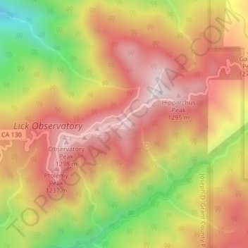
Nom : Carte topographique Katzman Automated Imaging Telescope, altitude, relief.
Altitude moyenne : 1 039 m
Altitude minimum : 638 m
Altitude maximum : 1 309 m
Faire un don
Équipez-vous pour votre prochaine aventure :
En tant que Partenaire Amazon, ce site perçoit une commission sur les achats éligibles sans surcoût pour vous.
Autres cartes topographiques
Cliquez sur une carte pour visualiser sa topographie, son altitude et son relief.
Faire un don
Équipez-vous pour votre prochaine aventure :
En tant que Partenaire Amazon, ce site perçoit une commission sur les achats éligibles sans surcoût pour vous.
Mount Madonna County Park
United States > California > Santa Clara County > Watsonville
Altitude moyenne : 330 m
San Martin
United States > California > Santa Clara County > San Martin
Due to the moderating influence of the Pacific Ocean, San Martin enjoys a warm, Mediterranean climate. Temperatures range from an average midsummer maximum of 90.2°F (32.3°C) to an average midwinter low of 33.6 °F (0.9 °C). Average annual rainfall is 480 mm (18.9 in), and the summer months are typically…
Altitude moyenne : 100 m
Faire un don
Équipez-vous pour votre prochaine aventure :
En tant que Partenaire Amazon, ce site perçoit une commission sur les achats éligibles sans surcoût pour vous.
Almaden Quicksilver County Park
United States > California > Santa Clara County > San Jose
Almaden Quicksilver County Park is a 4,163 acres (17 km²) park that includes the grounds of former mercury ("quicksilver") mines adjacent to south San Jose, California, USA. The park's elevation varies greatly: the most used entrances (on the east side of the park) are less than 600 feet (183 m) above sea…
Altitude moyenne : 267 m
Faire un don
Équipez-vous pour votre prochaine aventure :
En tant que Partenaire Amazon, ce site perçoit une commission sur les achats éligibles sans surcoût pour vous.
Sierra Vista Open Space Preserve
United States > California > Santa Clara County > San Jose
Altitude moyenne : 484 m
Fremont Older Open Space Preserve
United States > California > Santa Clara County
Altitude moyenne : 212 m
Martial Cottle Park
United States > California > Santa Clara County > San Jose
Altitude moyenne : 52 m
Faire un don
Équipez-vous pour votre prochaine aventure :
En tant que Partenaire Amazon, ce site perçoit une commission sur les achats éligibles sans surcoût pour vous.
Santa Teresa County Park
United States > California > Santa Clara County > San Jose
Altitude moyenne : 150 m
Los Gatos Creek County Park
United States > California > Santa Clara County > Campbell
Altitude moyenne : 75 m
Faire un don
Équipez-vous pour votre prochaine aventure :
En tant que Partenaire Amazon, ce site perçoit une commission sur les achats éligibles sans surcoût pour vous.