
Carte topographique Nationaal Park De Groote Peel
Carte interactive
Cliquez sur la carte pour afficher l’altitude.
À propos de cette carte
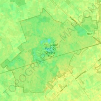
Nom : Carte topographique Nationaal Park De Groote Peel, altitude, relief.
Altitude moyenne : 29 m
Altitude minimum : 18 m
Altitude maximum : 33 m
Autres cartes topographiques
Cliquez sur une carte pour visualiser sa topographie, son altitude et son relief.
Schoor
Nederland > Limburg > Nederweert > Schoor
Schoor, Nederweert, Limburg, Nederland, 6031, Nederland
Altitude moyenne : 33 m