Géolocaliser

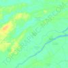
Carte topographique Tanjung Raja

Cliquez sur la carte pour afficher l’altitude.

À propos de cette carte

Nom : Carte topographique Tanjung Raja, altitude, relief.

Lieu : Tanjung Raja, Kecamatan Kateman, Indragiri Hilir, Riau, Sumatra, Indonesia (0.27081 103.57120 0.31081 103.61120)

Altitude moyenne : 4 m

Altitude minimum : -4 m

Altitude maximum : 12 m

Autres cartes topographiques

Cliquez sur une carte pour visualiser sa topographie, son altitude et son relief.

Kecamatan Tembilahan

Indonesia > Riau > Indragiri Hilir

Altitude moyenne : 4 m

Sungai Indragiri

Indonesia > Riau > Indragiri Hilir > Sapat

Altitude moyenne : 3 m

Kecamatan Kemuning

Indonesia > Riau > Indragiri Hilir

Altitude moyenne : 110 m

Kecamatan Mandah

Indonesia > Riau > Indragiri Hilir

Altitude moyenne : 3 m

Kecamatan Pelangiran

Indonesia > Riau > Indragiri Hilir

Altitude moyenne : 4 m

Kecamatan Gaung

Indonesia > Riau > Indragiri Hilir

Altitude moyenne : 7 m

Kecamatan Kateman

Indonesia > Riau > Indragiri Hilir

Altitude moyenne : 2 m

Kecamatan Reteh

Indonesia > Riau > Indragiri Hilir

Altitude moyenne : 4 m

Kecamatan Tempuling

Indonesia > Riau > Indragiri Hilir

Altitude moyenne : 7 m

Kecamatan Kempas

Indonesia > Riau > Indragiri Hilir

Altitude moyenne : 9 m

Équipez-vous pour votre prochaine aventure :

🧺Ensemble de sacs étanches - Compartimentez et protégez vos vêtements dans votre sac
🎒Sac à dos de randonnée 40L - Volume idéal pour une journée d'exploration topographique complète
❄️Crampons antidérapants - Adhérence sur neige et glace
📱Supports smartphone randonnée - Supports pratiques pour navigation mobile
📱Étui de téléphone étanche - Protégez votre smartphone des chutes dans l'eau ou de la boue

En tant que Partenaire Amazon, ce site perçoit une commission sur les achats éligibles sans surcoût pour vous.